Geolocate

Albi topographic map

Click on the map to display elevation.

About this map
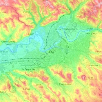
Name: Albi topographic map, elevation, terrain.

Location: Albi, Tarn, Occitania, Metropolitan France, 81000, France (43.88847 2.05376 43.96960 2.21184)

Average elevation: 210 m

Minimum elevation: 137 m

Maximum elevation: 318 m

Other topographic maps

Click on a map to view its topography, its elevation and its terrain.
Le Bez

France > Occitania > Tarn > Mirandol-Bourgnounac

Average elevation: 373 m

La Mothe

France > Occitania > Tarn > Castelnau-de-Lévis

Average elevation: 203 m

Gear up for your next adventure:

⛺Camping Essentials - All-in-one gear for a comfortable camping trip
🥾Hiking Leggings - Comfortable leggings for outdoor activities
🥾Trail Hiking Shoes - Durable shoes designed for rugged trails
🥾Trail Running Boots - Durable shoes designed for trail running
🥾Mountain Hiking Shoes - Shoes with superior grip for mountainous terrain

As an Amazon Associate, this site earns from qualifying purchases at no extra cost to you.