Geolocate

Zaandam topographic map

Click on the map to display elevation.

About this map

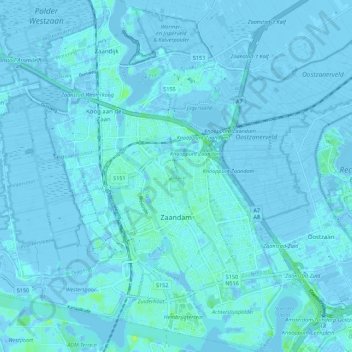
Name: Zaandam topographic map, elevation, terrain.

Location: Zaandam, Zaanstad, North Holland, Netherlands (52.41666 4.78344 52.48397 4.86281)

Average elevation: 0 m

Minimum elevation: -7 m

Maximum elevation: 10 m

Other topographic maps

Click on a map to view its topography, its elevation and its terrain.

Oosterwijzend

Netherlands > North Holland > Hoogkarspel

Average elevation: -2 m

Amsterdam

Netherlands > North Holland > Amsterdam

Average elevation: -1 m

Gear up for your next adventure:

🔥Camping Stove - Portable stoves to cook outdoors with ease
Backpacking Tent - Lightweight tent for long-distance hiking trips
🥾Mountain Hiking Boots - High-traction boots for rocky terrain
💡Solar Camping Lamp - Eco-friendly lighting for campsites
🕶️Polarized Sunglasses - Protect your eyes with durable polarized lenses

As an Amazon Associate, this site earns from qualifying purchases at no extra cost to you.