Geolocate

San Felipe topographic map

Click on the map to display elevation.

About this map

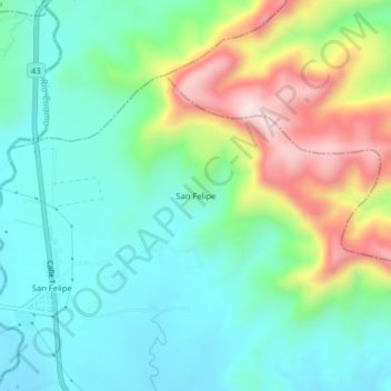
Name: San Felipe topographic map, elevation, terrain.

Location: San Felipe, Armero - Guayabal, Norte, Tolima, Colombia (5.11691 -74.90330 5.15691 -74.86330)

Average elevation: 487 m

Minimum elevation: 337 m

Maximum elevation: 830 m

Gear up for your next adventure:

Family Camping Tent - Spacious tent suitable for family camping trips
🧤Thermal Hiking Gloves - Grip-enhanced gloves for cold-weather altitude trekking
🛰️Satellite Messenger - Emergency communication for areas with no cell service
🥾Hiking Gaiters - Protect legs and shoes from mud, snow, and debris
🧥Packable Rain Jacket - Breathable waterproof layer for unpredictable weather

As an Amazon Associate, this site earns from qualifying purchases at no extra cost to you.