
Thank you for supporting this site ❤️
Make a donation
Make a donation
Gear up for your next adventure:
As an Amazon Associate, this site earns from qualifying purchases at no extra cost to you.
Alas-as topographic map
Click on the map to display elevation.
Thank you for supporting this site ❤️
Make a donation
Make a donation
Gear up for your next adventure:
As an Amazon Associate, this site earns from qualifying purchases at no extra cost to you.
About this map
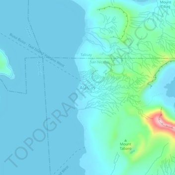
Name: Alas-as topographic map, elevation, terrain.
Location: Alas-as, San Nicolas, Batangas, Calabarzon, Philippines (13.99202 120.95434 14.03202 120.99434)
Average elevation: 35 m
Minimum elevation: 4 m
Maximum elevation: 280 m
Thank you for supporting this site ❤️
Make a donation
Make a donation
Gear up for your next adventure:
As an Amazon Associate, this site earns from qualifying purchases at no extra cost to you.