
Thank you for supporting this site ❤️
Make a donation
Make a donation
Gear up for your next adventure:
As an Amazon Associate, this site earns from qualifying purchases at no extra cost to you.
Töpingen topographic map
Click on the map to display elevation.
Thank you for supporting this site ❤️
Make a donation
Make a donation
Gear up for your next adventure:
As an Amazon Associate, this site earns from qualifying purchases at no extra cost to you.
About this map
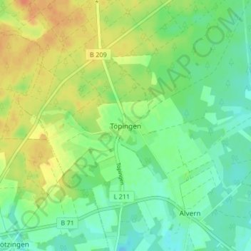
Name: Töpingen topographic map, elevation, terrain.
Location: Töpingen, Munster, Heidekreis, Niedersachsen, Deutschland (53.00979 9.98034 53.04979 10.02034)
Average elevation: 95 m
Minimum elevation: 80 m
Maximum elevation: 115 m
Thank you for supporting this site ❤️
Make a donation
Make a donation
Gear up for your next adventure:
As an Amazon Associate, this site earns from qualifying purchases at no extra cost to you.