
Cajo topographic map
Click on the map to display elevation.
About this map
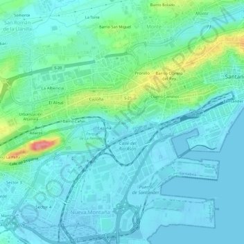
Name: Cajo topographic map, elevation, terrain.
Location: Cajo, Santander, Cantabria, 39011, España (43.43435 -3.85634 43.47435 -3.81634)
Average elevation: 18 m
Minimum elevation: -5 m
Maximum elevation: 97 m
Other topographic maps
Click on a map to view its topography, its elevation and its terrain.
Isla de la Virgen del Mar
España > Cantabria > Santander > San Román de la Llanilla > El Rostrío
Average elevation: 8 m