Geolocate

Stowe Fork topographic map

Click on the map to display elevation.

About this map

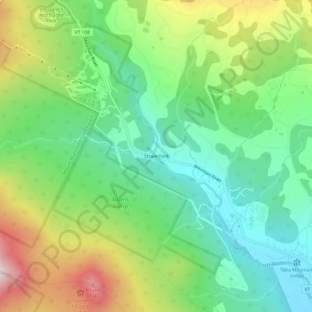
Name: Stowe Fork topographic map, elevation, terrain.

Location: Stowe Fork, Stowe, Lamoille County, Vermont, United States (44.48227 -72.77623 44.52227 -72.73623)

Average elevation: 432 m

Minimum elevation: 240 m

Maximum elevation: 780 m

Gear up for your next adventure:

🕶️Polarized Sunglasses - Reduces glare from snow and water at high elevations
🧥Fleece Jacket - Warm and lightweight jacket for layering
🧥Waterproof Jacket - Lightweight rain jackets for hiking and outdoor activities
🏕️Camping Hammock - Integrated protection for sleeping between trees
🧥Waterproof Pants - Keep dry during rainy hiking conditions

As an Amazon Associate, this site earns from qualifying purchases at no extra cost to you.