
Darby Island topographic map
Interactive map
Click on the map to display elevation.
About this map
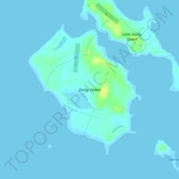
Name: Darby Island topographic map, elevation, terrain.
Location: Darby Island, Exuma, The Bahamas (23.83665 -76.23602 23.85644 -76.21734)
Average elevation: 2 m
Minimum elevation: -1 m
Maximum elevation: 25 m
Other topographic maps
Click on a map to view its topography, its elevation and its terrain.