Geolocate

Erzberg topographic map

Click on the map to display elevation.

About this map

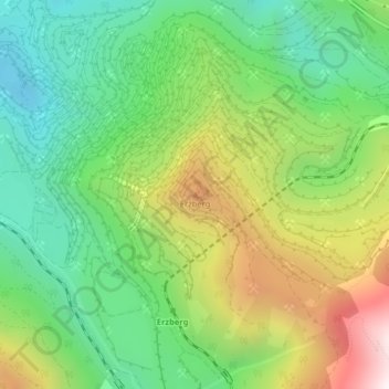
Name: Erzberg topographic map, elevation, terrain.

Location: Erzberg, Eisenerz, Bezirk Leoben, Styria, 8790, Austria (47.52439 14.91153 47.52449 14.91163)

Average elevation: 1,115 m

Minimum elevation: 728 m

Maximum elevation: 1,764 m

Gear up for your next adventure:

🧢Hiking Sun Hat - Wide-brimmed protection for exposed mountain ridges
🧭GPS Outdoor Watch - Smart watch for navigation and fitness tracking in nature
Lightweight Backpacking Tent - Compact tent for efficient hiking trips
🌡️Emergency Mylar Blankets - Compact thermal protection for unexpected nights outdoors
🔋Solar Power Bank - Keep your GPS and devices charged during long outdoor trips

As an Amazon Associate, this site earns from qualifying purchases at no extra cost to you.