
Thank you for supporting this site ❤️
Make a donation
Make a donation
Gear up for your next adventure:
As an Amazon Associate, this site earns from qualifying purchases at no extra cost to you.
Huilahuila topographic map
Click on the map to display elevation.
Thank you for supporting this site ❤️
Make a donation
Make a donation
Gear up for your next adventure:
As an Amazon Associate, this site earns from qualifying purchases at no extra cost to you.
About this map
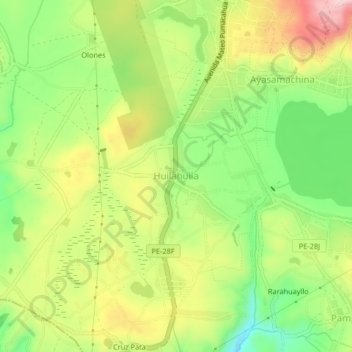
Name: Huilahuila topographic map, elevation, terrain.
Location: Huilahuila, Chinchero, Provincia de Urubamba, Cusco, Perú (-13.43958 -72.07821 -13.39958 -72.03821)
Average elevation: 3,723 m
Minimum elevation: 3,604 m
Maximum elevation: 3,865 m
Thank you for supporting this site ❤️
Make a donation
Make a donation
Gear up for your next adventure:
As an Amazon Associate, this site earns from qualifying purchases at no extra cost to you.