Geolocate

Hopewell topographic map

Click on the map to display elevation.

About this map

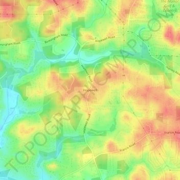
Name: Hopewell topographic map, elevation, terrain.

Location: Hopewell, Milton, Fulton County, Georgia, United States (34.13287 -84.30548 34.17287 -84.26548)

Average elevation: 325 m

Minimum elevation: 289 m

Maximum elevation: 357 m

Gear up for your next adventure:

📷Outdoor Action Camera - Capture high-elevation views and rugged adventures
🛏️Camping Sleeping Mat - Comfortable mats for sleeping outdoors
🚲MTB Frame Bag - Carry tools and maps directly on your bicycle frame
🥾Trail Hiking Socks - Comfortable socks to prevent blisters and fatigue
🔋Lithium AA Batteries - Long-lasting power that performs in extreme cold

As an Amazon Associate, this site earns from qualifying purchases at no extra cost to you.