Geolocate

Verona topographic map

Click on the map to display elevation.

About this map

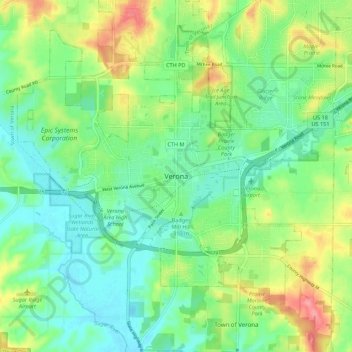
Name: Verona topographic map, elevation, terrain.

Location: Verona, Dane County, Wisconsin, 53593, United States (42.95055 -89.57356 43.03055 -89.49356)

Average elevation: 310 m

Minimum elevation: 279 m

Maximum elevation: 370 m

Gear up for your next adventure:

🧢Sun Protection Cap - Breathable cap to protect from sun exposure
🛶Waterproof Dry Bags - Keep electronics and clothes dry during river crossings
🧢Outdoor Visor - Breathable visor for sunny hikes
Camping Essentials - All-in-one gear for a comfortable camping trip
💡Compact LED Flashlight - Powerful and portable flashlight for outdoor use

As an Amazon Associate, this site earns from qualifying purchases at no extra cost to you.