
Thank you for supporting this site ❤️
Make a donation
Make a donation
Gear up for your next adventure:
As an Amazon Associate, this site earns from qualifying purchases at no extra cost to you.
Langenhagen topographic map
Click on the map to display elevation.
Thank you for supporting this site ❤️
Make a donation
Make a donation
Gear up for your next adventure:
As an Amazon Associate, this site earns from qualifying purchases at no extra cost to you.
About this map
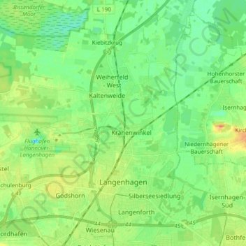
Name: Langenhagen topographic map, elevation, terrain.
Location: Langenhagen, Region Hannover, Lower Saxony, Germany (52.42284 9.62885 52.50638 9.77664)
Average elevation: 51 m
Minimum elevation: 38 m
Maximum elevation: 72 m
Thank you for supporting this site ❤️
Make a donation
Make a donation
Gear up for your next adventure:
As an Amazon Associate, this site earns from qualifying purchases at no extra cost to you.
Other topographic maps
Click on a map to view its topography, its elevation and its terrain.
Roderbruch
Germany > Lower Saxony > Region Hannover > Neustadt am Rübenberge > Dudensen
Average elevation: 48 m