Geolocate

Cauterets topographic map

Click on the map to display elevation.

Cauterets

L’altitude minimale, 503 m, se situe au nord, là où le gave de Cauterets quitte le territoire communal et entre sur celui de Soulom. L’altitude maximale avec 3 298 m correspond au point culminant des Pyrénées françaises, le Vignemale, marquant la frontière avec l’Espagne.

About this map
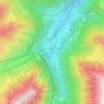
Name: Cauterets topographic map, elevation, terrain.

Location: Cauterets, Argelès-Gazost, Hautes-Pyrénées, Occitanie, France métropolitaine, 65110, France (42.86935 -0.13455 42.90935 -0.09455)

Average elevation: 1,412 m

Minimum elevation: 834 m

Maximum elevation: 2,250 m

Gear up for your next adventure:

🧴Outdoor Sunscreen - High SPF protection for high-altitude UV exposure
💡LED Camping Lantern - Illuminate your campsite with long-lasting lanterns
🔋Emergency Crank Radio - Weather alerts and power without needing batteries
🏕️Camping Hammock - Integrated protection for sleeping between trees
🥾Durable Hiking Shoes - Long-lasting shoes for frequent hiking

As an Amazon Associate, this site earns from qualifying purchases at no extra cost to you.