
Novi Sad City topographic map
Interactive map
Click on the map to display elevation.
About this map
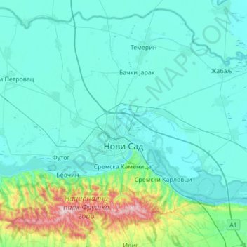
Name: Novi Sad City topographic map, elevation, terrain.
Average elevation: 122 m
Minimum elevation: 68 m
Maximum elevation: 538 m
Other topographic maps
Click on a map to view its topography, its elevation and its terrain.
Novi Sad
Serbia > Vojvodina > South Backa Administrative District
Novi Sad, City of Novi Sad, South Backa Administrative District, Vojvodina, 21000, Serbia
Average elevation: 135 m