Geolocate

Lada topographic map

Click on the map to display elevation.

About this map

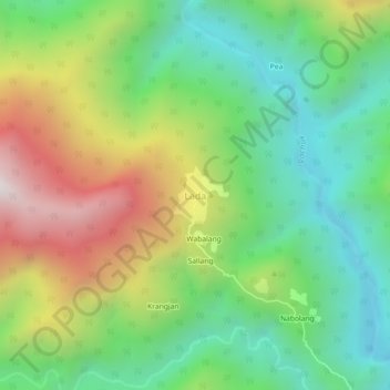
Name: Lada topographic map, elevation, terrain.

Location: Lada, Lada Circle, East Kameng, Arunachal Pradesh, India (27.55100 92.75767 27.59100 92.79767)

Average elevation: 1,270 m

Minimum elevation: 759 m

Maximum elevation: 2,127 m

Gear up for your next adventure:

🔥Emergency Fire Starter - Reliable ignition source for all weather conditions
🦶Anti-Blister Balm - Prevents friction and hotspots during long ascents
🥘Camping Cookware Set - Compact nesting pots and pans for trail cooking
💡LED Camping Lantern - Illuminate your campsite with long-lasting lanterns
🥾Waterproof Hiking Boots - Boots keeping your feet dry in wet conditions

As an Amazon Associate, this site earns from qualifying purchases at no extra cost to you.