Geolocate

Cancelada topographic map

Click on the map to display elevation.

About this map

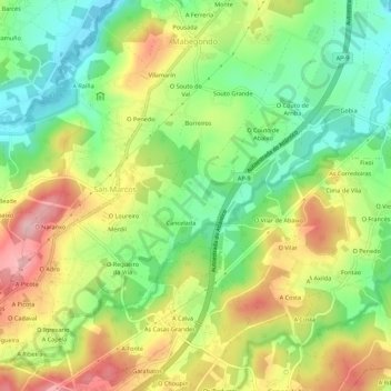
Name: Cancelada topographic map, elevation, terrain.

Location: Cancelada, Abegondo, La Coruña, Galicia, 15318, España (43.20335 -8.29984 43.24335 -8.25984)

Average elevation: 126 m

Minimum elevation: 40 m

Maximum elevation: 230 m

Gear up for your next adventure:

🚲Heavy Duty Bike Lock - Secure your bike at the trailhead or during stops
👟Trail Running Shoes - Agile footwear for fast-paced topographic exploration
🧢Outdoor Cap - Protective cap for sun and rain during hikes
🚲MTB Frame Bag - Carry tools and maps directly on your bicycle frame
🔥Emergency Fire Starter - Reliable ignition source for all weather conditions

As an Amazon Associate, this site earns from qualifying purchases at no extra cost to you.