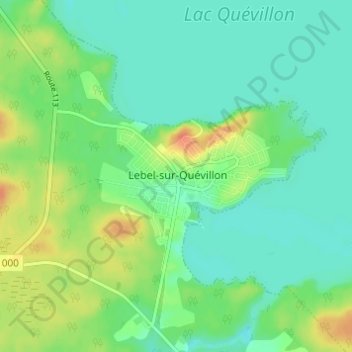
Lebel-sur-Quévillon topographic map
Interactive map
Click on the map to display elevation.
About this map
Name: Lebel-sur-Quévillon topographic map, elevation, terrain.
Average elevation: 285 m
Minimum elevation: 272 m
Maximum elevation: 311 m

Click on the map to display elevation.
Name: Lebel-sur-Quévillon topographic map, elevation, terrain.
Average elevation: 285 m
Minimum elevation: 272 m
Maximum elevation: 311 m