Geolocate

Chaquitos topographic map

Click on the map to display elevation.

About this map

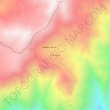
Name: Chaquitos topographic map, elevation, terrain.

Location: Chaquitos, Ayaví, Huaytará, Huancavelica, Perú (-13.72767 -75.35008 -13.68767 -75.31008)

Average elevation: 3,446 m

Minimum elevation: 2,562 m

Maximum elevation: 3,946 m

Gear up for your next adventure:

🥾Waterproof Hiking Boots - Essential footwear for rugged terrain and wet Canadian trails
🧥Waterproof Jacket - Lightweight rain jackets for hiking and outdoor activities
🧥Packable Rain Jacket - Breathable waterproof layer for unpredictable weather
🪑Insulated Seat Pad - Protect your seat from cold rocks and wet logs
🧦Merino Wool Socks - Moisture-wicking comfort for long-distance hiking

As an Amazon Associate, this site earns from qualifying purchases at no extra cost to you.