Geolocate

Terrasse Chamonix topographic map

Click on the map to display elevation.

About this map
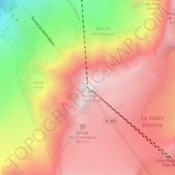
Name: Terrasse Chamonix topographic map, elevation, terrain.

Location: Terrasse Chamonix, Tunnel du Mont Blanc, Les Bossons, Chamonix-Mont-Blanc, Bonneville, Haute-Savoie, Auvergne-Rhône-Alpes, France métropolitaine, 74400, France (45.87925 6.88718 45.87935 6.88728)

Average elevation: 3,073 m

Minimum elevation: 1,924 m

Maximum elevation: 3,781 m

Other topographic maps

Click on a map to view its topography, its elevation and its terrain.

Gear up for your next adventure:

🧼Travel Hand Sanitizer - Keep hands clean when water is scarce
🧦Merino Wool Socks - Moisture-wicking comfort for long-distance hiking
🔋Lithium AA Batteries - Long-lasting power that performs in extreme cold
☕Camping Coffee Maker - Brew fresh coffee anywhere on the topographic map
🥾Waterproof Hiking Shoes - Durable shoes for wet and rugged trails

As an Amazon Associate, this site earns from qualifying purchases at no extra cost to you.