
Thank you for supporting this site ❤️
Make a donation
Make a donation
Gear up for your next adventure:
As an Amazon Associate, this site earns from qualifying purchases at no extra cost to you.
Blocona topographic map
Click on the map to display elevation.
Thank you for supporting this site ❤️
Make a donation
Make a donation
Gear up for your next adventure:
As an Amazon Associate, this site earns from qualifying purchases at no extra cost to you.
About this map
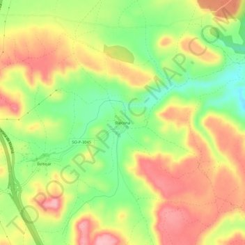
Name: Blocona topographic map, elevation, terrain.
Location: Blocona, Medinaceli, Soria, Castille-et-León, 42248, Espagne (41.20956 -2.46796 41.24956 -2.42796)
Average elevation: 1,115 m
Minimum elevation: 1,040 m
Maximum elevation: 1,183 m
Thank you for supporting this site ❤️
Make a donation
Make a donation
Gear up for your next adventure:
As an Amazon Associate, this site earns from qualifying purchases at no extra cost to you.