
Cragmere topographic map
Click on the map to display elevation.
About this map
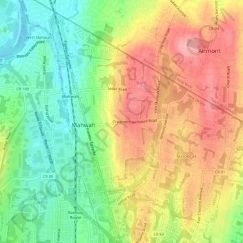
Name: Cragmere topographic map, elevation, terrain.
Average elevation: 136 m
Minimum elevation: 78 m
Maximum elevation: 196 m
Other topographic maps
Click on a map to view its topography, its elevation and its terrain.
Ramapo Valley County Reservation
United States > New Jersey > Bergen County > Mahwah
Average elevation: 178 m
Ramapo Mountain State Forest
United States > New Jersey > Bergen County > Mahwah
Average elevation: 151 m
Ramapo Valley County Reservation
United States > New Jersey > Bergen County > Mahwah
Average elevation: 178 m