Geolocate

Creel topographic map

Click on the map to display elevation.

About this map

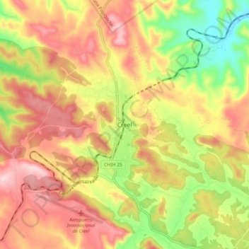
Name: Creel topographic map, elevation, terrain.

Location: Creel, Bocoyna, Chihuahua, 33200, Mexico (27.71302 -107.67435 27.79302 -107.59435)

Average elevation: 2,388 m

Minimum elevation: 2,214 m

Maximum elevation: 2,533 m

Gear up for your next adventure:

🌬️Windproof Camp Stove - Efficient cooking even on exposed mountain peaks
🧢Hiking Hat - Sun-protective and breathable hats for long treks
🦯Trekking Poles - Reduced impact on joints for steep topographic climbs
🧦Outdoor Socks - Durable socks designed for hiking and outdoor sports
🔭Compact Binoculars - Lightweight optics for scouting trails and wildlife

As an Amazon Associate, this site earns from qualifying purchases at no extra cost to you.