Geolocate

Diteki topographic map

Click on the map to display elevation.

About this map

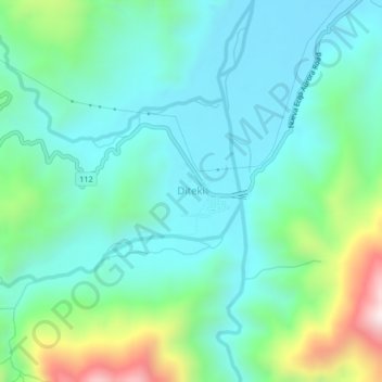
Name: Diteki topographic map, elevation, terrain.

Location: Diteki, San Luis, Aurora, Central Luzon, Philippines (15.64915 121.40901 15.68915 121.44901)

Average elevation: 277 m

Minimum elevation: 87 m

Maximum elevation: 894 m

Gear up for your next adventure:

🥾Waterproof Hiking Boots - Essential footwear for rugged terrain and wet Canadian trails
🗺️Topographic Maps - Detailed maps to explore trails, mountains, and wilderness areas
🕶️Polarized Sunglasses - Reduces glare from snow and water at high elevations
💡Compact LED Flashlight - Powerful and portable flashlight for outdoor use
🔋Emergency Crank Radio - Weather alerts and power without needing batteries

As an Amazon Associate, this site earns from qualifying purchases at no extra cost to you.