Geolocate

Monte Taburno topographic map

Click on the map to display elevation.

About this map
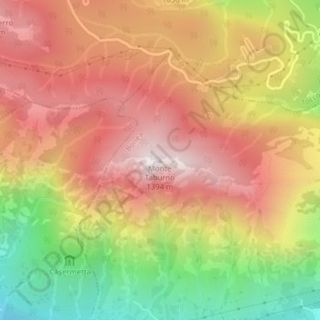
Name: Monte Taburno topographic map, elevation, terrain.

Location: Monte Taburno, Bonea, Benevento, Campania, 82016, Italia (41.09260 14.60358 41.09270 14.60368)

Average elevation: 925 m

Minimum elevation: 333 m

Maximum elevation: 1,373 m

Gear up for your next adventure:

💧Hydration Pack - Hands-free hydration system for long hikes
🥾Waterproof Hiking Boots - Essential footwear for rugged terrain and wet Canadian trails
💡Portable Camping Lamp - Rechargeable lamp for campsite lighting
🧥Softshell Hiking Jacket - The perfect balance of wind protection and breathability
💧Filtered Water Bottle - Safe drinking water on the go

As an Amazon Associate, this site earns from qualifying purchases at no extra cost to you.