
Thank you for supporting this site ❤️
Make a donation
Make a donation
Gear up for your next adventure:
As an Amazon Associate, this site earns from qualifying purchases at no extra cost to you.
Tabaka topographic map
Click on the map to display elevation.
Thank you for supporting this site ❤️
Make a donation
Make a donation
Gear up for your next adventure:
As an Amazon Associate, this site earns from qualifying purchases at no extra cost to you.
About this map
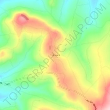
Name: Tabaka topographic map, elevation, terrain.
Location: Tabaka, Tabaka ward, Gucha South, Kisii County, Nyanza, Kenya (-0.76976 34.64647 -0.72976 34.68647)
Average elevation: 1,651 m
Minimum elevation: 1,538 m
Maximum elevation: 1,801 m
Thank you for supporting this site ❤️
Make a donation
Make a donation
Gear up for your next adventure:
As an Amazon Associate, this site earns from qualifying purchases at no extra cost to you.