Geolocate

Sumur Batu topographic map

Click on the map to display elevation.

About this map
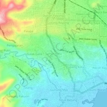
Name: Sumur Batu topographic map, elevation, terrain.

Location: Sumur Batu, Bandar Lampung, Lampung, Sumatra, 35401, Indonesia (-5.45500 105.23410 -5.41500 105.27410)

Average elevation: 73 m

Minimum elevation: -3 m

Maximum elevation: 253 m

Other topographic maps

Click on a map to view its topography, its elevation and its terrain.

Pulau Pasaran

Indonesia > Lampung > Bandar Lampung > Kangkung

Average elevation: 1 m

Gear up for your next adventure:

💧Hydration Bladder - Hands-free hydration solution for long treks
🔭Outdoor Binoculars - Lightweight binoculars for birdwatching and hiking
🛶Kayak Accessories - Essential gear for safe and fun kayaking adventures
🧥Waterproof Pants - Keep dry during rainy hiking conditions
💡LED Camping Lantern - Illuminate your campsite with long-lasting lanterns

As an Amazon Associate, this site earns from qualifying purchases at no extra cost to you.