
Thank you for supporting this site ❤️
Make a donation
Make a donation
Gear up for your next adventure:
As an Amazon Associate, this site earns from qualifying purchases at no extra cost to you.
Vresse-sur-Semois topographic map
Click on the map to display elevation.
Thank you for supporting this site ❤️
Make a donation
Make a donation
Gear up for your next adventure:
As an Amazon Associate, this site earns from qualifying purchases at no extra cost to you.
About this map
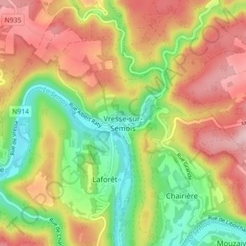
Name: Vresse-sur-Semois topographic map, elevation, terrain.
Location: Vresse-sur-Semois, Dinant, Namen, Wallonië, 5550, België (49.85298 4.91406 49.89298 4.95406)
Average elevation: 284 m
Minimum elevation: 168 m
Maximum elevation: 406 m
Thank you for supporting this site ❤️
Make a donation
Make a donation
Gear up for your next adventure:
As an Amazon Associate, this site earns from qualifying purchases at no extra cost to you.