
Tarrasa topographic map
Interactive map
Click on the map to display elevation.
About this map
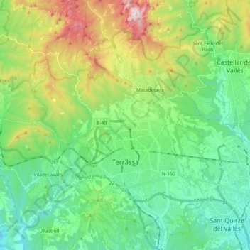
Name: Tarrasa topographic map, elevation, terrain.
Location: Tarrasa, Vallés Occidental, Cataluña, 08221, España (41.51630 1.94358 41.64872 2.06882)
Average elevation: 383 m
Minimum elevation: 100 m
Maximum elevation: 1,090 m