
Custer topographic map
Interactive map
Click on the map to display elevation.
About this map
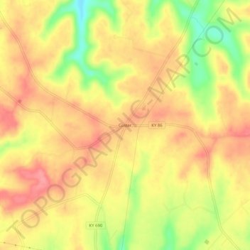
Name: Custer topographic map, elevation, terrain.
Location: Custer, Breckinridge County, Kentucky, 40115, United States (37.71840 -86.27469 37.75840 -86.23469)
Average elevation: 237 m
Minimum elevation: 182 m
Maximum elevation: 269 m
Other topographic maps
Click on a map to view its topography, its elevation and its terrain.
McDaniels
United States > Kentucky > Breckinridge County
McDaniels, Breckinridge County, Kentucky, 40152, United States
Average elevation: 189 m
Harned
United States > Kentucky > Breckinridge County
Harned, Breckinridge County, Kentucky, 40144, United States
Average elevation: 225 m
Garfield
United States > Kentucky > Breckinridge County
Garfield, Breckinridge County, Kentucky, 40144, United States
Average elevation: 230 m