
Make a donation
Gear up for your next adventure:
As an Amazon Associate, this site earns from qualifying purchases at no extra cost to you.
Paris topographic map
Click on the map to display elevation.
Make a donation
Gear up for your next adventure:
As an Amazon Associate, this site earns from qualifying purchases at no extra cost to you.
Paris
Paris lies in a high valley of the Rocky Mountains, at nearly 6,000 feet (1,830 m) in elevation.
Make a donation
Gear up for your next adventure:
As an Amazon Associate, this site earns from qualifying purchases at no extra cost to you.
About this map
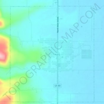
Name: Paris topographic map, elevation, terrain.
Location: Paris, Bear Lake County, Idaho, 83261, United States (42.21227 -111.42036 42.24362 -111.38607)
Average elevation: 1,831 m
Minimum elevation: 1,807 m
Maximum elevation: 1,978 m
Make a donation
Gear up for your next adventure:
As an Amazon Associate, this site earns from qualifying purchases at no extra cost to you.
Other topographic maps
Click on a map to view its topography, its elevation and its terrain.