
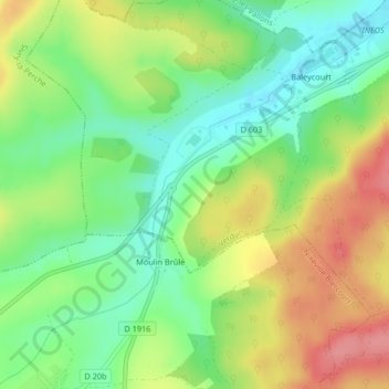
Le Mort-Homme topographic map
Interactive map
Click on the map to display elevation.
About this map
Name: Le Mort-Homme topographic map, elevation, terrain.
Average elevation: 256 m
Minimum elevation: 218 m
Maximum elevation: 305 m
Other topographic maps
Click on a map to view its topography, its elevation and its terrain.
Porte de la Tour du Champ
Porte de la Tour du Champ, Rue du Fort de Vaux, Cité Kennedy, La Blancharderie, Verdun, Meuse, Grand Est, France métropolitaine, 55100, France
Average elevation: 211 m