Geolocate

Sunnerby topographic map

Click on the map to display elevation.

About this map

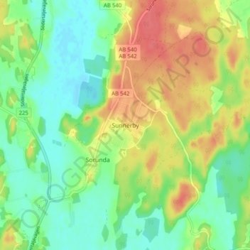
Name: Sunnerby topographic map, elevation, terrain.

Location: Sunnerby, Nynäshamns kommun, Stockholm County, 148 71, Sweden (58.99989 17.80964 59.03989 17.84964)

Average elevation: 39 m

Minimum elevation: 16 m

Maximum elevation: 69 m

Other topographic maps

Click on a map to view its topography, its elevation and its terrain.

Fjärdlång

Sweden > Stockholm County

Average elevation: 3 m

Nåttarö

Sweden > Stockholm County

Average elevation: 3 m

Stockholm

Sweden > Stockholm County

Average elevation: 25 m

Gear up for your next adventure:

❄️Traction Ice Cleats - Slip-on spikes for icy trails and winter hiking
🧦Thermal Socks - Warm socks for winter hiking or camping
🚑Survival Whistle - Signal for help across long distances in mountains
🧥Insulated Jacket - Keep warm in cold outdoor conditions
🔦LED Flashlight - Powerful and long-lasting flashlight for camping and emergencies

As an Amazon Associate, this site earns from qualifying purchases at no extra cost to you.