Geolocate

Dawarian topographic map

Click on the map to display elevation.

About this map

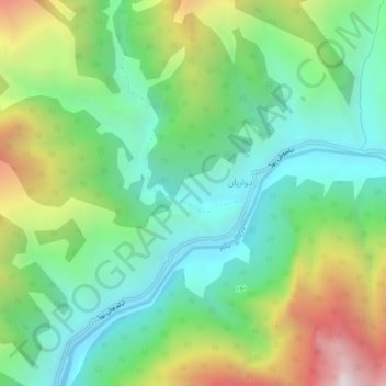
Name: Dawarian topographic map, elevation, terrain.

Location: Dawarian, Neelam Valley District, Azad Kashmir, Pakistan (34.70783 73.98685 34.74783 74.02685)

Average elevation: 2,133 m

Minimum elevation: 1,580 m

Maximum elevation: 3,216 m

Other topographic maps

Click on a map to view its topography, its elevation and its terrain.

Kotli District

Pakistan > Azad Kashmir

Average elevation: 898 m

Betar Nala

Pakistan > Azad Kashmir > Haveli District

Average elevation: 1,967 m

Shounter Lake

Pakistan > Azad Kashmir > Sharda Tehsil

Average elevation: 3,357 m

Bagh Tehsil

Pakistan > Azad Kashmir

Average elevation: 1,981 m

Tehsil Dadyal

Pakistan > Azad Kashmir

Average elevation: 474 m

Muzaffarabad District

Pakistan > Azad Kashmir

Average elevation: 1,826 m

Leepa

Pakistan > Azad Kashmir

Average elevation: 2,217 m

Jagran

Pakistan > Azad Kashmir > Kundal Shahi

Average elevation: 3,283 m

Muzaffarabad

Pakistan > Azad Kashmir

Average elevation: 793 m

Mirpur District

Pakistan > Azad Kashmir

Average elevation: 511 m

Gear up for your next adventure:

🕶️Polarized Sunglasses - Protect your eyes with durable polarized lenses
🥾Waterproof Hiking Boots - Essential footwear for rugged terrain and wet Canadian trails
🛏️Sleeping Bag - Warm and compact sleeping bags for outdoor camping
🔥Camping Stove - Portable stoves to cook outdoors with ease
Tent Footprint - Protect tent floor and increase durability

As an Amazon Associate, this site earns from qualifying purchases at no extra cost to you.