Geolocate

Edgewood topographic map

Click on the map to display elevation.

About this map

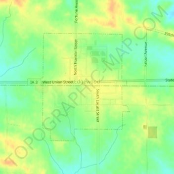
Name: Edgewood topographic map, elevation, terrain.

Location: Edgewood, Delaware County, Iowa, United States (42.63525 -91.41089 42.65195 -91.39208)

Average elevation: 352 m

Minimum elevation: 335 m

Maximum elevation: 369 m

Gear up for your next adventure:

🥾Durable Hiking Shoes - Long-lasting shoes for frequent hiking
🛰️Satellite Messenger - Emergency communication for areas with no cell service
💧Filtered Water Bottle - Safe drinking water on the go
🥾Mountain Hiking Shoes - Shoes with superior grip for mountainous terrain
👖Convertible Hiking Pants - Zip-off legs to adapt to changing weather conditions

As an Amazon Associate, this site earns from qualifying purchases at no extra cost to you.