Geolocate

Nax topographic map

Click on the map to display elevation.

About this map

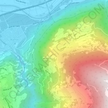
Name: Nax topographic map, elevation, terrain.

Location: Nax, Mont-Noble, Hérens, Wallis, 1973, Switzerland (46.20677 7.40503 46.24677 7.44503)

Average elevation: 990 m

Minimum elevation: 490 m

Maximum elevation: 1,907 m

Gear up for your next adventure:

🛶Kayak Dry Bag - Waterproof storage for kayaking adventures
🧥Waterproof Jacket - Lightweight rain jackets for hiking and outdoor activities
🛏️Camping Sleeping Mat - Comfortable mats for sleeping outdoors
🥾Waterproof Hiking Shoes - Durable shoes for wet and rugged trails
🦶Hiking Shoe Insoles - Added support for high arches and long days on feet

As an Amazon Associate, this site earns from qualifying purchases at no extra cost to you.