
Thank you for supporting this site ❤️
Make a donation
Make a donation
Gear up for your next adventure:
As an Amazon Associate, this site earns from qualifying purchases at no extra cost to you.
Gleidingen topographic map
Click on the map to display elevation.
Thank you for supporting this site ❤️
Make a donation
Make a donation
Gear up for your next adventure:
As an Amazon Associate, this site earns from qualifying purchases at no extra cost to you.
About this map
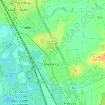
Name: Gleidingen topographic map, elevation, terrain.
Location: Gleidingen, Laatzen, Region Hannover, Niedersachsen, Deutschland (52.26241 9.81256 52.29517 9.87428)
Average elevation: 65 m
Minimum elevation: 54 m
Maximum elevation: 86 m
Thank you for supporting this site ❤️
Make a donation
Make a donation
Gear up for your next adventure:
As an Amazon Associate, this site earns from qualifying purchases at no extra cost to you.
Other topographic maps
Click on a map to view its topography, its elevation and its terrain.
Retentionsraum Bruchriede
Deutschland > Niedersachsen > Region Hannover > Laatzen
Average elevation: 69 m