Geolocate

Purén topographic map

Click on the map to display elevation.

About this map

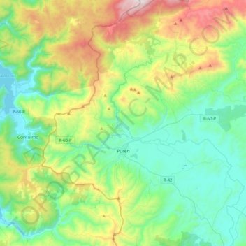
Name: Purén topographic map, elevation, terrain.

Location: Purén, Provincia de Malleco, Araucanía Region, Chile (-38.15669 -73.20633 -37.83763 -72.88977)

Average elevation: 389 m

Minimum elevation: 1 m

Maximum elevation: 1,401 m

Other topographic maps

Click on a map to view its topography, its elevation and its terrain.

Gear up for your next adventure:

🥾Trekking Poles - Adjustable trekking poles to reduce knee stress and improve stability
🍽️Titanium Camping Spork - Ultralight and indestructible eating utensil
🧦Merino Wool Socks - Moisture-wicking comfort for long-distance hiking
🕶️Polarized Sunglasses - Protect your eyes with durable polarized lenses
🐕Hiking Dog Pack - Let your canine companion carry their own water and food

As an Amazon Associate, this site earns from qualifying purchases at no extra cost to you.