Geolocate

Faya-Largeau topographic map

Click on the map to display elevation.

About this map

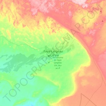
Name: Faya-Largeau topographic map, elevation, terrain.

Location: Faya-Largeau, Borkou, Chad (17.76093 18.93532 18.08093 19.25532)

Average elevation: 277 m

Minimum elevation: 198 m

Maximum elevation: 381 m

Gear up for your next adventure:

🧦Thermal Socks - Warm socks for winter hiking or camping
🥾Waterproof Hiking Shoes - Durable shoes for wet and rugged trails
💧Hydration Pack - Hands-free hydration system for long hikes
💧Collapsible Water Bottle - Space-saving water bottle for outdoor activities
🚲MTB Frame Bag - Carry tools and maps directly on your bicycle frame

As an Amazon Associate, this site earns from qualifying purchases at no extra cost to you.