Geolocate

Madrid topographic map

Click on the map to display elevation.

About this map

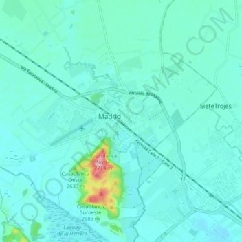
Name: Madrid topographic map, elevation, terrain.

Location: Madrid, Cundinamarca, Colombia (4.69171 -74.29918 4.77171 -74.21918)

Average elevation: 2,554 m

Minimum elevation: 2,529 m

Maximum elevation: 2,728 m

Other topographic maps

Click on a map to view its topography, its elevation and its terrain.

La Estancia

Colombia > Cundinamarca > Madrid

Average elevation: 2,566 m

Gear up for your next adventure:

🥾Trekking Boots - Durable boots for long-distance trekking
💧Filtered Water Bottle - Safe drinking water on the go
📷Outdoor Action Camera - Capture high-elevation views and rugged adventures
👟Trail Running Shoes - Agile footwear for fast-paced topographic exploration
💧Hydration Pack - Hands-free hydration system for long hikes

As an Amazon Associate, this site earns from qualifying purchases at no extra cost to you.