
Le Bourg topographic map
Interactive map
Click on the map to display elevation.
About this map
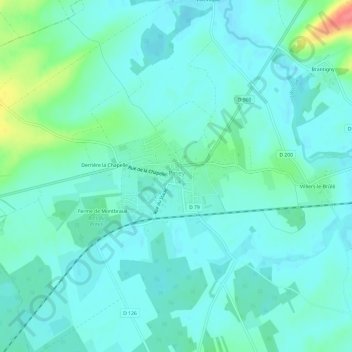
Name: Le Bourg topographic map, elevation, terrain.
Average elevation: 121 m
Minimum elevation: 108 m
Maximum elevation: 173 m
Other topographic maps
Click on a map to view its topography, its elevation and its terrain.
Villevoque
France > Grand Est > Aube > Piney
Villevoque, Piney, Troyes, Aube, Grand Est, France métropolitaine, 10220, France
Average elevation: 123 m