
Thank you for supporting this site ❤️
Make a donation
Make a donation
Gear up for your next adventure:
As an Amazon Associate, this site earns from qualifying purchases at no extra cost to you.
Hangar topographic map
Click on the map to display elevation.
Thank you for supporting this site ❤️
Make a donation
Make a donation
Gear up for your next adventure:
As an Amazon Associate, this site earns from qualifying purchases at no extra cost to you.
About this map
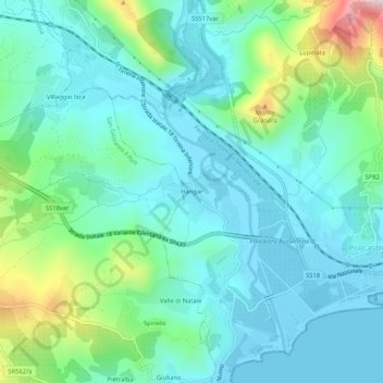
Name: Hangar topographic map, elevation, terrain.
Location: Hangar, Santa Marina, Salerno, Kampanien, 84067, Italien (40.06243 15.47752 40.10243 15.51752)
Average elevation: 91 m
Minimum elevation: -2 m
Maximum elevation: 420 m
Thank you for supporting this site ❤️
Make a donation
Make a donation
Gear up for your next adventure:
As an Amazon Associate, this site earns from qualifying purchases at no extra cost to you.