Geolocate

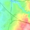
Somorrostro topographic map

Click on the map to display elevation.

About this map

Name: Somorrostro topographic map, elevation, terrain.

Location: Somorrostro, Las Serillas, Sexmo de Segovia, Comunidad de Ciudad y Tierra de Segovia, Segovia, Castilla y León, 40001, España (40.94563 -4.15422 40.96563 -4.13422)

Average elevation: 965 m

Minimum elevation: 897 m

Maximum elevation: 1,021 m

Other topographic maps

Click on a map to view its topography, its elevation and its terrain.
Perogordo

España > Castilla y León > Segovia > Madrona

Average elevation: 978 m

Fuentemilanos

España > Castilla y León > Segovia

Average elevation: 1,011 m

Plaza de la Merced

España > Castilla y León > Segovia

Average elevation: 983 m

Plaza San Nicolás

España > Castilla y León > Segovia

Average elevation: 992 m

Fuentemilanos

España > Castilla y León > Segovia

Average elevation: 1,011 m

Gear up for your next adventure:

🕶️Polarized Sunglasses - Protect your eyes with durable polarized lenses
💡Compact LED Flashlight - Powerful and portable flashlight for outdoor use
🥾Waterproof Hiking Boots - Essential footwear for rugged terrain and wet Canadian trails
🥾Hiking Shoes - Durable and comfortable shoes for trail hiking
💧Reusable Water Bottle - Durable water bottles for hydration on trails

As an Amazon Associate, this site earns from qualifying purchases at no extra cost to you.