Geolocate

Tablac topographic map

Click on the map to display elevation.

About this map

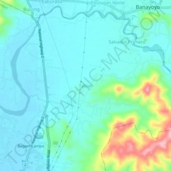
Name: Tablac topographic map, elevation, terrain.

Location: Tablac, Candon, Ilocos Sur, Ilocos Region, 2710, Philippines (17.19783 120.44449 17.23783 120.48449)

Average elevation: 38 m

Minimum elevation: 4 m

Maximum elevation: 171 m

Gear up for your next adventure:

🔋Emergency Crank Radio - Weather alerts and power without needing batteries
👟Leg Gaiters - Keep debris, mud, and snow out of your boots
💧Hydration Pack - Hands-free hydration system for long hikes
🧦Outdoor Socks - Durable socks designed for hiking and outdoor sports
🧥Packable Rain Jacket - Breathable waterproof layer for unpredictable weather

As an Amazon Associate, this site earns from qualifying purchases at no extra cost to you.