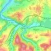
Bösenbrunn topographic map
Click on the map to display elevation.
Bösenbrunn
Zu Bösenbrunn gehören Mühlleithe, Kulm, Untertriebelbach und die Einzelanwesen Klingerstein und Beucholdsgrün. Mühlleithe schließt sich am Hang des Triebelbaches nahtlos an das Hauptdorf an. Untertriebelbach liegt zwei Kilometer aufwärts im Triebelbachtal und war dem Ursprung nach eine Bergarbeitersiedlung. Die Rodesiedlung Kulm liegt in nordwestlicher Richtung in 480 Meter Seehöhe. Der Weiler tauchte 1681 erstmals in einem Lehnbrief für Adam Ulrich II. von Neidberg auf Bösenbrunn und Planschwitz auf und ist 1752 urkundlich belegt.
About this map

Name: Bösenbrunn topographic map, elevation, terrain.
Average elevation: 502 m
Minimum elevation: 373 m
Maximum elevation: 630 m
Other topographic maps
Click on a map to view its topography, its elevation and its terrain.