Geolocate

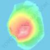
Pig Island topographic map

Click on the map to display elevation.

About this map

Name: Pig Island topographic map, elevation, terrain.

Location: Pig Island, French Southern and Antarctic Lands, France (-46.32458 49.87827 -45.86793 50.58424)

Average elevation: 6 m

Minimum elevation: 0 m

Maximum elevation: 829 m

Other topographic maps

Click on a map to view its topography, its elevation and its terrain.

Gear up for your next adventure:

🥾Lightweight Hiking Shoes - Comfortable shoes for day hikes
👟Sport Hiking Sandals - Breathable footwear for water crossings and camp rest
🌬️Windproof Camp Stove - Efficient cooking even on exposed mountain peaks
🧢Hiking Hat - Sun-protective and breathable hats for long treks
🪜Heavy Duty Carabiners - Multi-use clips for securing gear to your backpack

As an Amazon Associate, this site earns from qualifying purchases at no extra cost to you.