Geolocate

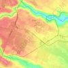
Hospital ward topographic map

Click on the map to display elevation.

About this map

Name: Hospital ward topographic map, elevation, terrain.

Location: Hospital ward, Thika Town, Kiambu, Kenya (-1.06234 37.07802 -1.03235 37.16976)

Average elevation: 1,484 m

Minimum elevation: 1,429 m

Maximum elevation: 1,531 m

Other topographic maps

Click on a map to view its topography, its elevation and its terrain.

Thika

Kenya > Kiambu > Thika Town > Thika Township ward

Average elevation: 1,499 m

Thika

Kenya > Kiambu > Thika Town

Average elevation: 1,495 m

Maguguni

Kenya > Kiambu > Thika Town > Ngoliba ward

Average elevation: 1,391 m

Munyu

Kenya > Kiambu > Thika Town > Gatuanyaga ward

Average elevation: 1,461 m

Athi

Kenya > Kiambu > Thika Town > Ngoliba ward

Average elevation: 1,400 m

Gear up for your next adventure:

🧴Insect Repellent - Protect yourself from bugs during outdoor adventures
🧣Merino Neck Gaiter - Protects against wind, sun, and cold at high altitudes
🩹Moleskin Blister Pads - Direct protection for painful foot pressure points
🦌Outdoor Trail Camera - Monitor wildlife activity near your favorite spots
🧥Waterproof Jacket - Lightweight rain jackets for hiking and outdoor activities

As an Amazon Associate, this site earns from qualifying purchases at no extra cost to you.