Geolocate

Dahilayan topographic map

Click on the map to display elevation.

About this map
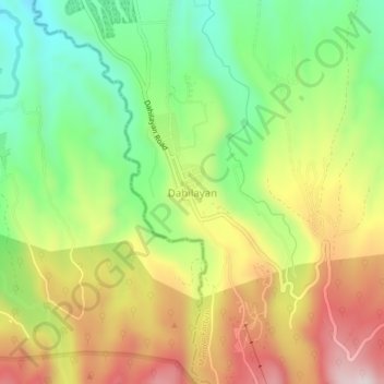
Name: Dahilayan topographic map, elevation, terrain.

Location: Dahilayan, Manolo Fortich, Bukidnon, Northern Mindanao, 8703, Philippines (8.19945 124.83189 8.23945 124.87189)

Average elevation: 1,116 m

Minimum elevation: 903 m

Maximum elevation: 1,373 m

Other topographic maps

Click on a map to view its topography, its elevation and its terrain.

Alae River

Philippines > Bukidnon > Manolo Fortich

Average elevation: 337 m

Mangima River

Philippines > Bukidnon > Manolo Fortich

Average elevation: 410 m

Gear up for your next adventure:

🪑Insulated Seat Pad - Protect your seat from cold rocks and wet logs
🥾Durable Hiking Shoes - Long-lasting shoes for frequent hiking
🧢Hiking Sun Hat - Wide-brimmed protection for exposed mountain ridges
🧼Travel Hand Sanitizer - Keep hands clean when water is scarce
🧤Insulated Winter Gloves - Heavy-duty protection for sub-zero Canadian adventures

As an Amazon Associate, this site earns from qualifying purchases at no extra cost to you.