
Thank you for supporting this site ❤️
Make a donation
Make a donation
Gear up for your next adventure:
As an Amazon Associate, this site earns from qualifying purchases at no extra cost to you.
Seghouane topographic map
Click on the map to display elevation.
Thank you for supporting this site ❤️
Make a donation
Make a donation
Gear up for your next adventure:
As an Amazon Associate, this site earns from qualifying purchases at no extra cost to you.
About this map
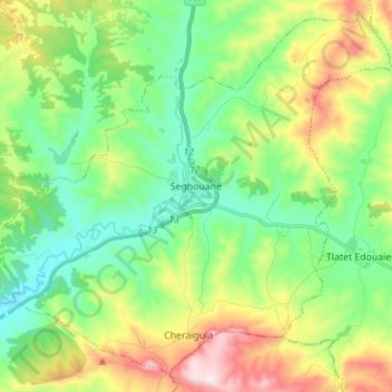
Name: Seghouane topographic map, elevation, terrain.
Location: Seghouane, Daïra Seghouane, Médéa, 26000, Algérie (35.94656 2.83600 36.04917 2.97520)
Average elevation: 800 m
Minimum elevation: 611 m
Maximum elevation: 1,185 m
Thank you for supporting this site ❤️
Make a donation
Make a donation
Gear up for your next adventure:
As an Amazon Associate, this site earns from qualifying purchases at no extra cost to you.