Geolocate

Bas Papillon topographic map

Click on the map to display elevation.

About this map

Name: Bas Papillon topographic map, elevation, terrain.

Location: Bas Papillon, Liffré, Rennes, Ille-et-Vilaine, Bretagne, France métropolitaine, 35340, France (48.21940 -1.55277 48.25940 -1.51277)

Average elevation: 77 m

Minimum elevation: 46 m

Maximum elevation: 113 m

Other topographic maps

Click on a map to view its topography, its elevation and its terrain.
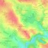
35340

France > Bretagne > Ille-et-Vilaine > Liffré

Average elevation: 79 m

Gear up for your next adventure:

🧥Thermal Layer - Insulating layer for cold outdoor conditions
🔥Camping Stove - Portable stoves to cook outdoors with ease
🥾Waterproof Trail Shoes - Shoes designed to handle wet terrain
💡Compact LED Flashlight - Powerful and portable flashlight for outdoor use
🧰Multitool Knife - Compact and versatile tool for outdoor use

As an Amazon Associate, this site earns from qualifying purchases at no extra cost to you.